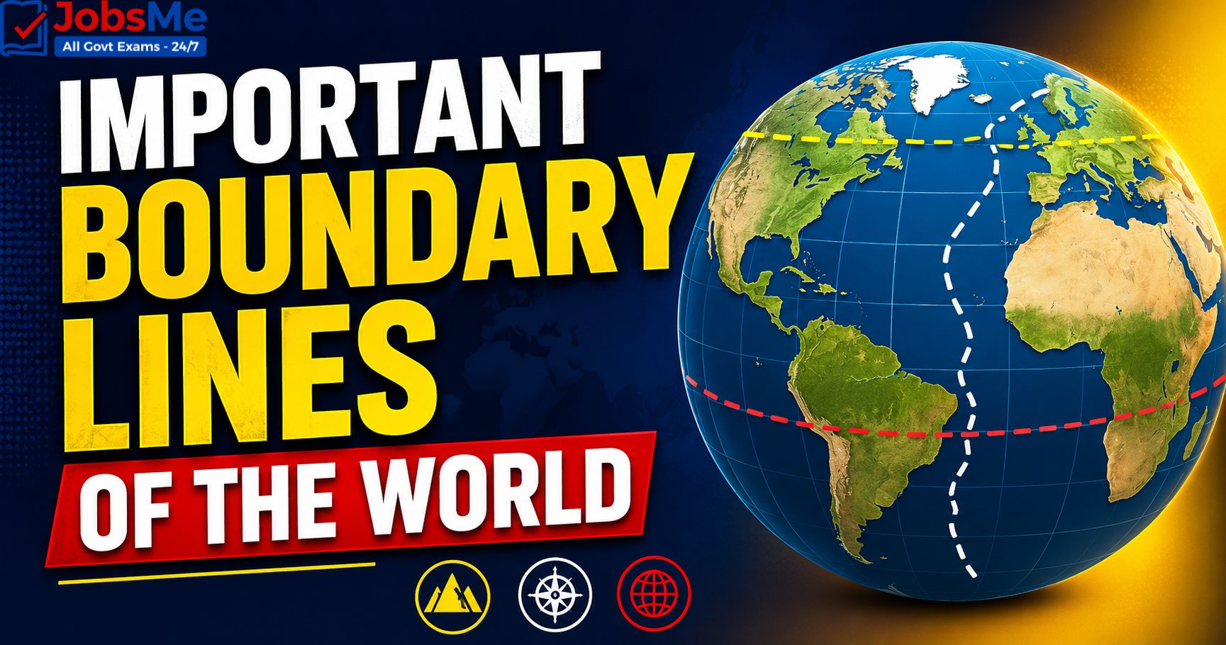
International Boundary Lines of the World and India – Static GK & General Awareness for Competitive Exams with Memory Tricks
This article presents a complete list of important international boundary lines of the world and India along with the countries they separate, their historical background, and exam-relevant facts, making it an essential resource for UPSC, SSC, IBPS, RRB, and other government exam aspirants. It includes major boundary lines like the Radcliffe Line, McMahon Line, Durand Line, 38th Parallel, 49th Parallel, Maginot Line, Hindenburg Line, LoC, LAC, and the Blue Line, along with memory tricks and one-liners for quick revision. All facts are arranged in exam-ready format to help students score better in General Awareness sections.
Jump to section
- Introduction
- Core Concepts: Classification of Boundary Lines
- Major International Boundary Lines of the World
- India-Pakistan Disputed Areas and Sub-Boundary Issues
- International Boundary Lines of India
- India's Land Borders - Quick Reference (Length and States)
- Region-Wise Boundary Lines - Quick Reference
- Border Guarding Forces of India
- Memory Tricks and Mnemonics
- Additional Notes
- One-Liners for Quick Revision
Introduction
International boundary lines are far more than just lines on a map — they are the legal, political, and historical dividers that define where one nation ends and another begins. From the heavily militarised 38th Parallel between the two Koreas to the longest peaceful border in the world along the 49th Parallel between the USA and Canada, boundary lines reflect treaties, wars, colonial decisions, and natural features. For India, the Radcliffe Line, McMahon Line, Line of Control (LoC), and Line of Actual Control (LAC) form the backbone of its territorial identity and continue to shape diplomacy in South Asia.
Questions on international boundary lines appear regularly in UPSC Prelims, SSC CGL, IBPS PO, RRB NTPC, SBI Clerk, State PCS, and various Insurance and Defence exams. Questions typically ask which two countries a particular line separates, who demarcated it, in what year, and whether it is recognised by both sides. This article brings together all the key facts in a structured, exam-ready format. To explore other related Static GK topics, you can refer to the Important Boundary Lines of the World and India - Static GK guide on Jobsme.in.
Boundary lines are also closely linked to current affairs themes such as India-China LAC tensions, Indo-Pakistan ceasefire violations, the Durand Line dispute, the Israel-Lebanon Blue Line situation, and the Korean DMZ — making this topic doubly important for aspirants targeting UPSC Mains, Essay papers, and Defence interviews.
Core Concepts: Classification of Boundary Lines
International boundary lines are broadly classified based on their nature, origin, and recognition status.
Classification Based on Nature
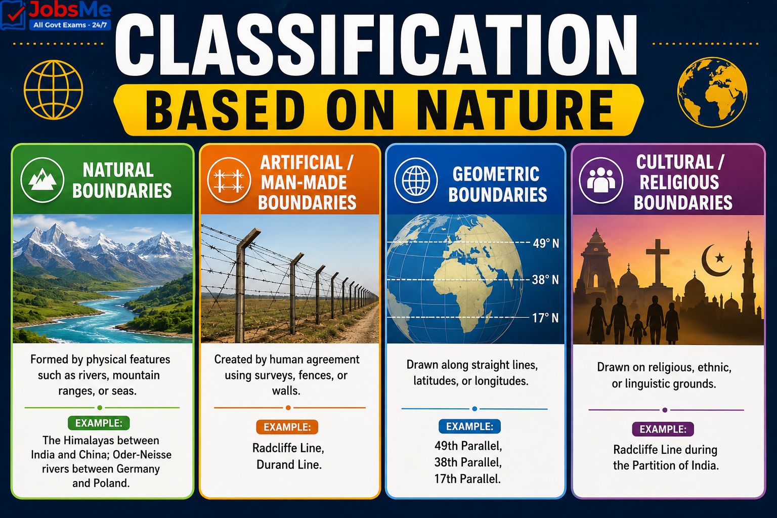
- Natural Boundaries: Formed by physical features such as rivers, mountain ranges, or seas. Example: The Himalayas between India and China; Oder-Neisse rivers between Germany and Poland.
- Artificial / Man-Made Boundaries: Created by human agreement using surveys, fences, or walls. Example: Radcliffe Line, Durand Line.
- Geometric Boundaries: Drawn along straight lines, latitudes, or longitudes. Example: 49th Parallel, 38th Parallel, 17th Parallel.
- Cultural / Religious Boundaries: Drawn on religious, ethnic, or linguistic grounds. Example: Radcliffe Line during the Partition of India.
Classification Based on Recognition
- De Jure Borders: Legally recognised by both nations through treaties. Example: Radcliffe Line (India-Pakistan).
- De Facto Borders: Not formally recognised but functionally operational. Example: McMahon Line (disputed by China), LoC (India-Pakistan in J&K).
- Disputed Borders: Borders where both nations claim differing alignments. Example: LAC between India and China; Durand Line between Pakistan and Afghanistan.
- Defensive / Military Lines: Built as fortifications during wars, often obsolete today. Example: Maginot Line, Hindenburg Line, Siegfried Line, Mannerheim Line.
Major International Boundary Lines of the World
The following table presents all major international boundary lines of the world along with the countries they separate, the year they were drawn, and key features.
| Boundary Line | Separates | Year / Origin | Key Features / Exam Notes |
|---|---|---|---|
| Radcliffe Line | India and Pakistan (and India-Bangladesh) | 17 August 1947 | Drawn by Sir Cyril Radcliffe during Partition of India; completed in just 5 weeks; divides Punjab and Bengal; West Radcliffe = Indo-Pak, East Radcliffe = Indo-Bangladesh. |
| McMahon Line | India and China | 1914 (Simla Convention) | Drawn by Sir Henry McMahon; de facto border in the eastern sector (Arunachal Pradesh); China refuses to recognise it claiming Tibet had no right to sign treaties. |
| Durand Line | Pakistan and Afghanistan | 1893 | Demarcated by Sir Mortimer Durand and the Amir of Afghanistan; ~2,640 km long; not recognised by Afghanistan; a small ~106 km stretch lies in PoK region. |
| Line of Control (LoC) | India and Pakistan (in Jammu and Kashmir) | 1972 (Shimla Agreement) | De facto military boundary in J&K; replaced the earlier Ceasefire Line (1949); heavily militarised; ~740 km long. |
| Line of Actual Control (LAC) | India and China | Post-1962 War | Disputed line of effective control; ~3,488 km long; divided into Western (Ladakh), Middle (HP-Uttarakhand), and Eastern (Arunachal) sectors. |
| Actual Ground Position Line (AGPL) | India and Pakistan (in Siachen) | 1984 onwards | Demarcates positions in the Siachen Glacier area; runs along the Saltoro Ridge; not part of the LoC. |
| 49th Parallel | USA and Canada | 1818 / 1846 (Oregon Treaty) | Longest undefended international border in the world (~5,525 miles); follows 49° N latitude; also informally called the "Medicine Line". |
| 38th Parallel | North Korea and South Korea | End of WWII (1945) | Divides the Korean Peninsula; forms the centre of the Demilitarized Zone (DMZ); world's most heavily guarded border. |
| 17th Parallel | North Vietnam and South Vietnam | 1954 (Geneva Accords) | Divided the two Vietnams; rendered irrelevant after Vietnam's unification in 1976. |
| 20th Parallel | Libya and Sudan | — | Located at 20° N latitude; political divider in North Africa. |
| 22nd Parallel | Egypt and Sudan | — | 22° N latitude marks a major portion of the Sudan-Egypt border. |
| 25th Parallel | Mauritania and Mali | — | Marks the northernmost section of the Mali-Mauritania border. |
| 31st Parallel | Iran and Iraq | — | Marks the border between Iraq and Iran at 31° N latitude; also separates US states Louisiana and Mississippi. |
| Hindenburg Line | Germany and Poland (originally French territory in WWI) | World War I | German defensive line during WWI; rendered irrelevant by the Treaty of Versailles (1919). |
| Maginot Line | France and Germany | 1930s (built by France) | French defensive fortifications before WWII; named after André Maginot, French Minister of War; bypassed and made obsolete by German invasion. |
| Mannerheim Line | Finland and Russia (USSR) | 1920s-1939 | Built by Finland on the Karelian Isthmus as a defensive line against Soviet Union; used in the Winter War of WWII. |
| Oder-Neisse Line | Germany and Poland | 1945 (Potsdam Conference) | Runs along the Oder and Lusatian Neisse rivers; finalised at Potsdam; formally recognised by unified Germany in 1990. |
| Siegfried Line | Germany and France | 1930s | Built by Germany on the Western Front as an extension of the Hindenburg Line; counterpart to the Maginot Line. |
| Blue Line | Israel and Lebanon | 7 June 2000 | Published by the United Nations to confirm Israel's withdrawal from Lebanon; not a permanent international border but a "line of withdrawal". |
| Purple Line | Israel and Syria | 1949 / 1967 | Ceasefire line in the Golan Heights region following the Arab-Israeli wars. |
| Green Line (Cyprus) / Attila Line | Republic of Cyprus and Turkish Cyprus | 1964 / extended 1974 | UN-patrolled buffer zone (UNFICYP); demilitarized zone separating Greek and Turkish Cypriots. |
| Green Line (Israel) | Israel and West Bank / Gaza | 1949 Armistice | 1949 armistice line between Israel and Arab neighbours after the Arab-Israeli war. |
| Medicine Line | USA and Canada | 1818 / 1846 | Informal name for the 49th Parallel; coined by Native Americans who believed soldiers stopped chasing them once they crossed it. |
| International Date Line | Imaginary line in the Pacific Ocean | 1884 | Follows the 180° meridian; serves as the basis for date change worldwide; zigzags to avoid landmasses. |
| Iron Curtain | Western Europe and Eastern Bloc (Cold War) | 1945-1991 | Metaphorical, ideological boundary during the Cold War; term popularised by Winston Churchill in 1946. |
| Bamboo Curtain | Communist Asia and Capitalist Asia (Cold War) | Post-1949 | Cold War ideological boundary in Asia; eastern counterpart of the Iron Curtain; centred around China. |
| Curzon Line | Poland and Russia / USSR | 1919 | Proposed by British Foreign Secretary Lord Curzon as the eastern boundary of Poland; basis for modern Poland-Belarus-Ukraine border. |
| Northern Limit Line (NLL) | North Korea and South Korea (maritime) | 1953 | Maritime extension of the 38th Parallel in the Yellow Sea; disputed by North Korea. |
| 24th Parallel | India and Pakistan (Pakistan's claim) | — | Pakistan claims this as the border in the Rann of Kutch / Sir Creek region; India does not recognise it; tied to the unresolved Sir Creek dispute. |
| 141st Meridian West | USA (Alaska) and Canada | 1825 (Anglo-Russian Treaty); 1903 (Alaska Boundary Tribunal) | Longest geometric meridian land boundary in the world; runs north-south between Alaska (USA) and Yukon (Canada). |
| 35th Parallel | US internal border | — | Forms boundaries between North Carolina-Georgia and Tennessee-Georgia/Alabama/Mississippi in the United States. |
| 45th Parallel | US internal border | — | Forms most of the boundary between Montana and Wyoming; geographically marks the halfway point between the Equator and the North Pole. |
India-Pakistan Disputed Areas and Sub-Boundary Issues
Beyond the Radcliffe Line and LoC, several sub-boundary areas remain contentious between India and Pakistan. The table below covers these high-yield exam topics.
| Area / Line | Location | Key Features / Exam Notes |
|---|---|---|
| Sir Creek | Rann of Kutch (Gujarat-Sindh border) | 96-km tidal estuary between India and Pakistan; originally called Ban Ganga; India claims mid-channel (Thalweg principle); Pakistan claims eastern bank; affects EEZ delimitation. |
| Rann of Kutch | Gujarat (India) and Sindh (Pakistan) | 1968 International Tribunal awarded ~90% to India; Pakistan claimed border along the 24th parallel; partial dispute remains in Sir Creek area. |
| NJ9842 | Northernmost point of LoC | Last point where LoC was demarcated; beyond this lies the Siachen Glacier — origin of the Saltoro / AGPL standoff. |
| Saltoro Ridge / AGPL | Siachen Glacier area, Ladakh | India's positions are forward of the Saltoro Ridge after Operation Meghdoot (1984); world's highest battlefield. |
International Boundary Lines of India
India shares its land and maritime borders with seven neighbouring countries — Pakistan, China, Nepal, Bhutan, Myanmar, Bangladesh, and Afghanistan — along with maritime neighbour Sri Lanka. The table below lists all of India's international boundary lines with their length and key features.
| S.No | Boundary Line | India's Neighbour | Approx. Length | Key Features / Exam Notes |
|---|---|---|---|---|
| 1 | Radcliffe Line | Pakistan (and Bangladesh) | Indo-Pak ~3,323 km; Indo-Bangladesh ~4,096 km | Drawn in 1947 by Sir Cyril Radcliffe during Partition; states bordering Pakistan — Gujarat, Rajasthan, Punjab, J&K (Ladakh); states bordering Bangladesh — WB, Assam, Meghalaya, Tripura, Mizoram. |
| 2 | McMahon Line | China | ~1,140 km (Eastern Sector) | Drawn in 1914 at Simla Convention by Sir Henry McMahon; runs along Arunachal Pradesh; disputed by China. |
| 3 | Line of Actual Control (LAC) | China | ~3,488 km | De facto border between India and China; divided into Western (Ladakh), Middle (HP-Uttarakhand), and Eastern (Sikkim-Arunachal) sectors; flashpoints — Galwan, Doklam, Tawang. |
| 4 | Line of Control (LoC) | Pakistan (in J&K) | ~740 km | Military boundary in J&K; came into being after Shimla Agreement 1972; replaced earlier Ceasefire Line (1949). |
| 5 | Actual Ground Position Line (AGPL) | Pakistan (Siachen) | ~110 km | Demarcates positions in Siachen Glacier; runs along Saltoro Ridge; world's highest battlefield. |
| 6 | Durand Line | Afghanistan (via PoK) | ~106 km (claimed by India in PoK) | Drawn in 1893; India claims a small section in the Ladakh/PoK region; primarily India-Afghanistan via territory currently held by Pakistan. |
| 7 | Indo-Nepal Border | Nepal | ~1,751 km | Open border based on Treaty of Sugauli (1816) and Treaty of Peace and Friendship (1950); states involved — Uttarakhand, UP, Bihar, WB, Sikkim. |
| 8 | Indo-Bhutan Border | Bhutan | ~699 km | Open border based on Treaty of Peace and Friendship (1949, revised 2007); states involved — Sikkim, WB, Assam, Arunachal Pradesh. |
| 9 | Indo-Myanmar Border | Myanmar | ~1,643 km | States involved — Arunachal Pradesh, Nagaland, Manipur, Mizoram; managed under Free Movement Regime (FMR, partially suspended); fencing ongoing. |
| 10 | Palk Strait / Maritime Border | Sri Lanka | Maritime | Separates Tamil Nadu coast from northern Sri Lanka; includes Palk Bay; Katchatheevu Island ceded to Sri Lanka in 1974. |
India's Land Borders - Quick Reference (Length and States)
| Neighbour | Length (km) | Indian States Bordering |
|---|---|---|
| Bangladesh | ~4,096 km | West Bengal, Assam, Meghalaya, Tripura, Mizoram |
| China | ~3,488 km | Ladakh (UT), Himachal Pradesh, Uttarakhand, Sikkim, Arunachal Pradesh |
| Pakistan | ~3,323 km | Gujarat, Rajasthan, Punjab, J&K, Ladakh (UT) |
| Nepal | ~1,751 km | Uttarakhand, Uttar Pradesh, Bihar, West Bengal, Sikkim |
| Myanmar | ~1,643 km | Arunachal Pradesh, Nagaland, Manipur, Mizoram |
| Bhutan | ~699 km | Sikkim, West Bengal, Assam, Arunachal Pradesh |
| Afghanistan | ~106 km | Ladakh (UT) — via PoK |
| Total Land Border | ~15,106 km | 17 Indian states/UTs touch international borders |
Region-Wise Boundary Lines - Quick Reference
Boundary Lines in Europe
| Boundary Line | Between |
|---|---|
| Hindenburg Line | Germany and Poland (formerly French territory) |
| Maginot Line | France and Germany |
| Siegfried Line | Germany and France |
| Mannerheim Line | Finland and Russia |
| Oder-Neisse Line | Germany and Poland |
| Curzon Line | Poland and Russia/USSR |
| Iron Curtain | Western Europe and Eastern Bloc (Cold War) |
Boundary Lines in Asia
| Boundary Line | Between |
|---|---|
| Radcliffe Line | India and Pakistan / Bangladesh |
| McMahon Line | India and China |
| Durand Line | Pakistan and Afghanistan |
| Line of Control (LoC) | India and Pakistan (J&K) |
| Line of Actual Control (LAC) | India and China |
| 38th Parallel | North and South Korea |
| 17th Parallel | North and South Vietnam (historical) |
| 31st Parallel | Iran and Iraq |
| Bamboo Curtain | Communist Asia and Capitalist Asia |
Boundary Lines in the Americas
| Boundary Line | Between |
|---|---|
| 49th Parallel | USA and Canada |
| Medicine Line | USA and Canada (informal name) |
| Rio Grande | USA and Mexico (natural river boundary) |
Boundary Lines in Africa and the Middle East
| Boundary Line | Between |
|---|---|
| 20th Parallel | Libya and Sudan |
| 22nd Parallel | Egypt and Sudan |
| 25th Parallel | Mauritania and Mali |
| Blue Line | Israel and Lebanon |
| Purple Line | Israel and Syria (Golan Heights) |
| Green Line (Israel) | Israel and West Bank/Gaza |
| Green Line (Cyprus) / Attila Line | Republic of Cyprus and Turkish Cyprus |
Border Guarding Forces of India
India deploys specialised Central Armed Police Forces (CAPFs) and the Army to guard its different international borders. This is a frequently asked topic in SSC, RRB, Defence, and CAPF exams.
| Border | Guarding Force | Key Notes |
|---|---|---|
| India-Pakistan (Radcliffe Line) | Border Security Force (BSF) | Raised 1965; "First Line of Defence"; also guards India-Bangladesh border. |
| India-Bangladesh | Border Security Force (BSF) | Longest land border (~4,096 km); heavy fencing and floodlights. |
| India-China (LAC) | Indo-Tibetan Border Police (ITBP) | Raised 1962 after Sino-Indian War; "Himveers"; guards the entire 3,488 km LAC. |
| India-Nepal | Sashastra Seema Bal (SSB) | Open border; SSB also guards Indo-Bhutan border. |
| India-Bhutan | Sashastra Seema Bal (SSB) | Open border based on the 1949 Treaty of Peace and Friendship. |
| India-Myanmar | Assam Rifles | Oldest paramilitary force (1835); known as "Sentinels of the Northeast". |
| LoC (J&K) and AGPL (Siachen) | Indian Army | Military line; not guarded by paramilitary forces. |
| Coastal / Maritime borders | Indian Coast Guard (ICG) + Indian Navy | Established 1978; guards EEZ, coastal waters, and maritime boundaries with Sri Lanka, Pakistan, etc. |
Memory Tricks and Mnemonics
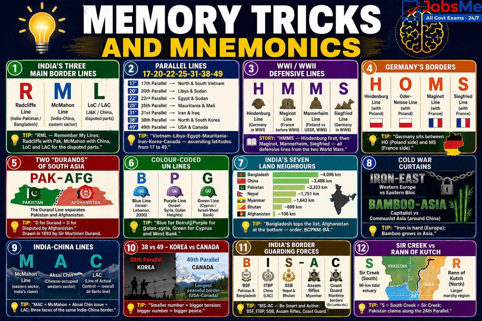
Trick 1: India's Three Main Border Lines - "RML"
- R - Radcliffe Line (India-Pakistan / Bangladesh).
- M - McMahon Line (India-China, eastern sector).
- L - Line of Control / Line of Actual Control (J&K / China).
Tip: "RML — Remember My Lines: Radcliffe with Pak, McMahon with China, LoC and LAC for the disputed parts."
Trick 2: Parallel Lines - "17-20-22-25-31-38-49"
- 17th Parallel → North and South Vietnam.
- 20th Parallel → Libya and Sudan.
- 22nd Parallel → Egypt and Sudan.
- 25th Parallel → Mauritania and Mali.
- 31st Parallel → Iran and Iraq.
- 38th Parallel → North and South Korea.
- 49th Parallel → USA and Canada.
Tip: "Vietnam-Libya-Egypt-Mauritania-Iran-Korea-Canada — ascending latitudes from 17 to 49."
Trick 3: WWI / WWII Defensive Lines - "HMMS"
- H - Hindenburg Line (Germany in WWI).
- M - Maginot Line (France before WWII).
- M - Mannerheim Line (Finland vs USSR, WWII).
- S - Siegfried Line (Germany in WWII).
Story: "HMMS — Hindenburg first, then Maginot, Mannerheim, Siegfried — all defensive lines from the two World Wars."
Trick 4: Germany's Borders - "HOMS"
- H - Hindenburg Line (with Poland).
- O - Oder-Neisse Line (with Poland).
- M - Maginot Line (with France).
- S - Siegfried Line (with France).
Tip: "Germany sits between HO (Poland side) and MS (France side)."
Trick 5: Two "Durands" of South Asia - "Pak-Afg"
The Durand Line separates Pakistan and Afghanistan. Tip: "D for Durand = D for Disputed by Afghanistan." Drawn in 1893 by Sir Mortimer Durand.
Trick 6: Colour-Coded UN Lines - "BPG"
- B - Blue Line (Israel-Lebanon, 2000).
- P - Purple Line (Israel-Syria, Golan Heights).
- G - Green Line (Cyprus / Israel-West Bank).
Tip: "Blue for Beirut, Purple for golan-syria, Green for Cyprus and West Bank."
Trick 7: India's Seven Land Neighbours - "Bangladesh-China-Pakistan-Nepal-Myanmar-Bhutan-Afghanistan" (length order)
- Bangladesh → ~4,096 km (longest).
- China → ~3,488 km.
- Pakistan → ~3,323 km.
- Nepal → ~1,751 km.
- Myanmar → ~1,643 km.
- Bhutan → ~699 km.
- Afghanistan → ~106 km (shortest).
Tip: "Bangladesh tops the list, Afghanistan at the bottom — order: BCPNM-BA."
Trick 8: Cold War Curtains - "Iron-East, Bamboo-Asia"
- Iron Curtain → Western Europe vs Eastern Bloc.
- Bamboo Curtain → Capitalist vs Communist Asia (around China).
Tip: "Iron is hard (Europe); Bamboo grows in Asia."
Trick 9: India-China Lines - "MAC" (3 names, same border)
- M - McMahon Line (eastern sector, India's claim).
- A - Aksai Chin (Chinese-occupied western sector).
- C - LAC (Line of Actual Control — overall de facto line).
Tip: "MAC = McMahon + Aksai Chin issue + LAC; three faces of the same India-China border."
Trick 10: 38 vs 49 - Korea vs Canada
Both are parallels separating two countries — 38 is heavily militarised (Korea), 49 is the longest peaceful border (USA-Canada). Tip: "Smaller number = bigger tension; bigger number = bigger peace."
Trick 11: India's Border Guarding Forces - "BIS-AC"
- B - BSF → Pakistan and Bangladesh.
- I - ITBP → China (LAC).
- S - SSB → Nepal and Bhutan.
- A - Assam Rifles → Myanmar.
- C - Coast Guard → Maritime borders (Sri Lanka etc.).
Tip: "BIS-AC — Be Smart and Active: BSF, ITBP, SSB, Assam Rifles, Coast Guard."
Trick 12: Sir Creek vs Rann of Kutch - "S for South, R for Rann"
The Sir Creek is the southern part (96-km tidal estuary), and the Rann of Kutch is the larger marshy region to the north. Tip: "S = South Creek = Sir Creek; Pakistan claims along the 24th Parallel."
Additional Notes
Frequently Confused Facts
- Radcliffe Line: Drawn on 17 August 1947 by Sir Cyril Radcliffe; took just 5 weeks to complete; separates India from both Pakistan and Bangladesh.
- McMahon Line vs LAC: McMahon Line is only the eastern sector boundary (drawn 1914); LAC is the entire India-China de facto border including western (Ladakh) and middle sectors.
- LoC vs LAC: LoC is between India and Pakistan in J&K (post-Shimla Agreement 1972); LAC is between India and China.
- LoC vs Ceasefire Line: The 1949 Karachi Agreement created the Ceasefire Line; the 1972 Shimla Agreement renamed and modified it as the Line of Control.
- Durand Line: Between Pakistan and Afghanistan; not recognised by Afghanistan; only about 106 km falls in the India-claimed PoK region.
- 49th Parallel: Longest undefended border in the world (USA-Canada); also called the "Medicine Line".
- 38th Parallel: Most heavily militarised border; centre of the Korean DMZ.
- Blue Line vs Green Line: Blue Line is Israel-Lebanon (2000); Green Line refers to two different lines — one in Cyprus and one between Israel and the West Bank.
- Hindenburg vs Siegfried: Hindenburg Line was a WWI defensive line; Siegfried Line was its WWII extension on the Western Front.
- Maginot vs Mannerheim: Maginot built by France against Germany; Mannerheim built by Finland against the USSR.
- Highest international border: China-Nepal border passes through the summit of Mount Everest (8,848.86 m).
- Most divided border town: Baarle-Hertog (Belgium) and Baarle-Nassau (Netherlands) — 26 enclaves intertwined.
- India-Myanmar border: 1,643 km long; touches Arunachal Pradesh, Nagaland, Manipur, Mizoram (not Indo-Bhutan as commonly confused).
- Maritime boundary with Sri Lanka: Palk Strait; Katchatheevu Island ceded to Sri Lanka in 1974.
- 17th Parallel: Historical line dividing North and South Vietnam; rendered irrelevant after unification in 1976.
- Sir Creek vs Rann of Kutch: Sir Creek is a 96-km tidal estuary (southern dispute); Rann of Kutch is the larger marshy region (resolved largely in 1968 — 90% to India).
- Thalweg Principle: The boundary in a navigable river follows the middle of the deepest channel; India cites this principle in the Sir Creek dispute.
- NJ9842: The last demarcated point of the LoC in J&K; beyond this lies the undefined Siachen sector where the AGPL exists.
- Operation Meghdoot (1984): Indian military operation to secure the Siachen Glacier — established positions along the Saltoro Ridge.
- BSF on two borders: The Border Security Force guards BOTH the India-Pakistan and India-Bangladesh borders (longest mandate).
- Assam Rifles, not Assam Police: India's oldest paramilitary force (1835) guards the Indo-Myanmar border, not state police.
Repeating PYQ Patterns
- UPSC Prelims: Frequently asks about LAC sectors, Durand Line disputes, Radcliffe Line history, McMahon Line significance, and Indo-Myanmar Free Movement Regime.
- SSC CGL and CHSL: Match-the-column questions linking boundary lines to countries; Radcliffe, McMahon, Durand, 38th Parallel, and 49th Parallel are most common.
- IBPS PO and Clerk: One-liner questions on who drew which line and the year it was drawn.
- RRB NTPC and Group D: Direct questions on which countries are separated by which line — especially the parallels (17, 20, 22, 25, 31, 38, 49).
- State PCS and Defence Exams: Length of India's borders, names of states bordering each neighbour, and key passes/forts along borders.
Quick Insight
Boundary lines are central to current affairs themes such as the India-China LAC standoff in Eastern Ladakh, ceasefire violations along the LoC, the Indo-Myanmar Free Movement Regime suspension, the Israel-Lebanon Blue Line tensions, and the Afghanistan-Pakistan Durand Line dispute. Aspirants should regularly track border infrastructure projects (BRO, CPEC, BCIM corridor), boundary settlement talks, and diplomatic developments around enclaves and disputed territories. For the latest updates, follow the daily current affairs section on Jobsme.in.
This topic also pairs well with related Static GK areas such as Countries, Capitals and Currencies of the World and International Organisations and their Headquarters, since border disputes are often handled through international forums like the UN, ICJ, and regional bodies.
One-Liners for Quick Revision
- Radcliffe Line → India and Pakistan (and India-Bangladesh) → Drawn by Sir Cyril Radcliffe in 1947 during Partition; completed in 5 weeks.
- McMahon Line → India and China → Drawn in 1914 at Simla Convention by Sir Henry McMahon; disputed by China.
- Durand Line → Pakistan and Afghanistan → Drawn by Sir Mortimer Durand in 1893; not recognised by Afghanistan.
- Line of Control (LoC) → India and Pakistan (J&K) → De facto military boundary; ~740 km; emerged after Shimla Agreement 1972.
- Line of Actual Control (LAC) → India and China → ~3,488 km; Western (Ladakh), Middle (HP-UK), Eastern (Sikkim-Arunachal) sectors.
- Actual Ground Position Line (AGPL) → India and Pakistan (Siachen) → Along Saltoro Ridge; world's highest battlefield.
- 49th Parallel → USA and Canada → World's longest undefended border (~5,525 miles); Oregon Treaty of 1846.
- 38th Parallel → North and South Korea → Most heavily militarised border; centre of Korean DMZ.
- 17th Parallel → North and South Vietnam → 1954 Geneva Accords; irrelevant after 1976 unification.
- 20th Parallel → Libya and Sudan → 20° N latitude.
- 22nd Parallel → Egypt and Sudan → 22° N latitude.
- 25th Parallel → Mauritania and Mali → Northernmost section.
- 31st Parallel → Iran and Iraq → 31° N latitude.
- Hindenburg Line → Germany defensive line in WWI → Rendered irrelevant by Treaty of Versailles, 1919.
- Maginot Line → France and Germany → Built by France in the 1930s; named after André Maginot; bypassed by Germans in WWII.
- Mannerheim Line → Finland and Russia (USSR) → Finnish defensive line in the Winter War (WWII).
- Oder-Neisse Line → Germany and Poland → Along Oder and Lusatian Neisse rivers; Potsdam Conference 1945.
- Siegfried Line → Germany and France → Extension of Hindenburg Line on Western Front in WWII.
- Blue Line → Israel and Lebanon → Published by UN on 7 June 2000.
- Purple Line → Israel and Syria → Ceasefire line in Golan Heights.
- Green Line (Cyprus) → Republic of Cyprus and Turkish Cyprus → UN buffer zone (UNFICYP); 1964 / extended 1974.
- Green Line (Israel) → Israel and West Bank/Gaza → 1949 Armistice line.
- Medicine Line → USA and Canada → Informal Native American name for the 49th Parallel.
- International Date Line → Pacific Ocean → Follows 180° meridian; zigzags to avoid landmasses.
- Iron Curtain → Western Europe and Eastern Bloc → Cold War metaphor; coined by Winston Churchill (1946).
- Bamboo Curtain → Communist Asia and Capitalist Asia → Asian counterpart of Iron Curtain.
- Curzon Line → Poland and Russia/USSR → Proposed by Lord Curzon in 1919.
- Northern Limit Line (NLL) → North and South Korea (maritime) → Yellow Sea extension of 38th Parallel.
- Longest international border in the world → USA-Canada (49th Parallel) → ~8,891 km.
- Highest international border in the world → China-Nepal → Passes through Mt Everest summit (8,848.86 m).
- Most heavily guarded border → Korean DMZ (~250 km long, 4 km wide).
- Most lit-up border → India-Pakistan border (visible from ISS).
- Most divided border town → Baarle-Hertog (Belgium) and Baarle-Nassau (Netherlands).
- India-Bangladesh border → ~4,096 km → India's longest international border; states — WB, Assam, Meghalaya, Tripura, Mizoram.
- India-China border → ~3,488 km → States — Ladakh, HP, Uttarakhand, Sikkim, Arunachal Pradesh.
- India-Pakistan border → ~3,323 km → States — Gujarat, Rajasthan, Punjab, J&K, Ladakh.
- India-Nepal border → ~1,751 km → Open border; Treaty of Sugauli (1816); Peace and Friendship Treaty (1950).
- India-Myanmar border → ~1,643 km → States — Arunachal, Nagaland, Manipur, Mizoram.
- India-Bhutan border → ~699 km → Open border; Treaty of Peace and Friendship (1949, revised 2007).
- India-Afghanistan border → ~106 km → Shortest; via PoK in Ladakh.
- Total Indian land border → ~15,106 km → 17 states/UTs touch international borders.
- India's maritime neighbour → Sri Lanka → Palk Strait / Palk Bay; Katchatheevu Island ceded in 1974.
- Country sharing land border with most Indian states → China and Bangladesh (5 each).
- Indian state with most international borders → Arunachal Pradesh (China, Bhutan, Myanmar).
- Only UT sharing international borders → Ladakh (China, Pakistan, Afghanistan via PoK).
- India's land border with Pakistan named → Radcliffe Line (peace border); LoC (military line in J&K).
- India-China line by name → McMahon Line (eastern) + LAC (overall).
- Border force on Indo-Pak border → Border Security Force (BSF).
- Border force on Indo-China border → Indo-Tibetan Border Police (ITBP).
- Border force on Indo-Nepal and Indo-Bhutan border → Sashastra Seema Bal (SSB).
- Border force on Indo-Myanmar and Indo-Bangladesh border → Assam Rifles (Myanmar); BSF (Bangladesh).
- Sir Creek → India and Pakistan (Gujarat-Sindh) → 96-km tidal estuary; India claims mid-channel (Thalweg); Pakistan claims eastern bank; affects EEZ.
- Rann of Kutch dispute → 1968 Tribunal awarded ~90% to India; Pakistan had claimed half along the 24th Parallel.
- 24th Parallel → Pakistan's claim line in the Rann of Kutch; not recognised by India.
- NJ9842 → Northernmost point of LoC → Beyond this lies Siachen Glacier; origin of Saltoro / AGPL standoff.
- Saltoro Ridge / Operation Meghdoot → 1984 → India occupied Saltoro before Pakistan; established AGPL.
- 141st Meridian West → USA (Alaska) and Canada (Yukon) → Longest geometric meridian boundary in the world.
- 35th Parallel → US internal border → North Carolina-Georgia and Tennessee-Georgia.
- 45th Parallel → US internal border → Halfway point between the Equator and the North Pole.
- BSF raising year → 1965 → Pak-Bangladesh border guarding force; "First Line of Defence".
- ITBP raising year → 1962 → Indo-China border (LAC); "Himveers".
- SSB → Sashastra Seema Bal → Indo-Nepal and Indo-Bhutan open borders.
- Assam Rifles → 1835 → Oldest paramilitary force; guards Indo-Myanmar border.
- Indian Coast Guard → 1978 → Maritime borders and EEZ.
- Thalweg Principle → International law principle → Border in navigable river follows mid-channel; cited by India in Sir Creek dispute.
- Operation Meghdoot → 13 April 1984 → Indian operation to take control of Siachen Glacier.
For more Static GK topics like rivers, mountains, and biosphere reserves of India, explore the Static GK section on Jobsme.in. You can also test your knowledge with the Static GK Quiz and check out the latest exam notifications at Latest Government Job Notifications.
Free quiz • No signup required
Put this topic into practice with Indian Cultural Institutions – Static GK MCQ Quiz. It is the quickest way to reinforce what you just learned.
Frequently Asked Questions
Which line separates India and Pakistan?
Which boundary line separates India and China?
Who demarcated the Durand Line and between which countries does it lie?
What is the difference between the LoC and the LAC?
Which parallel of latitude divided North and South Korea?
Which is the longest undefended border in the world?
Which Indian state has the longest international border?
What is the Blue Line and which countries does it separate?
Which boundary lines were defensive military lines during the World Wars?
Which line passes through the summit of Mount Everest?

About the author