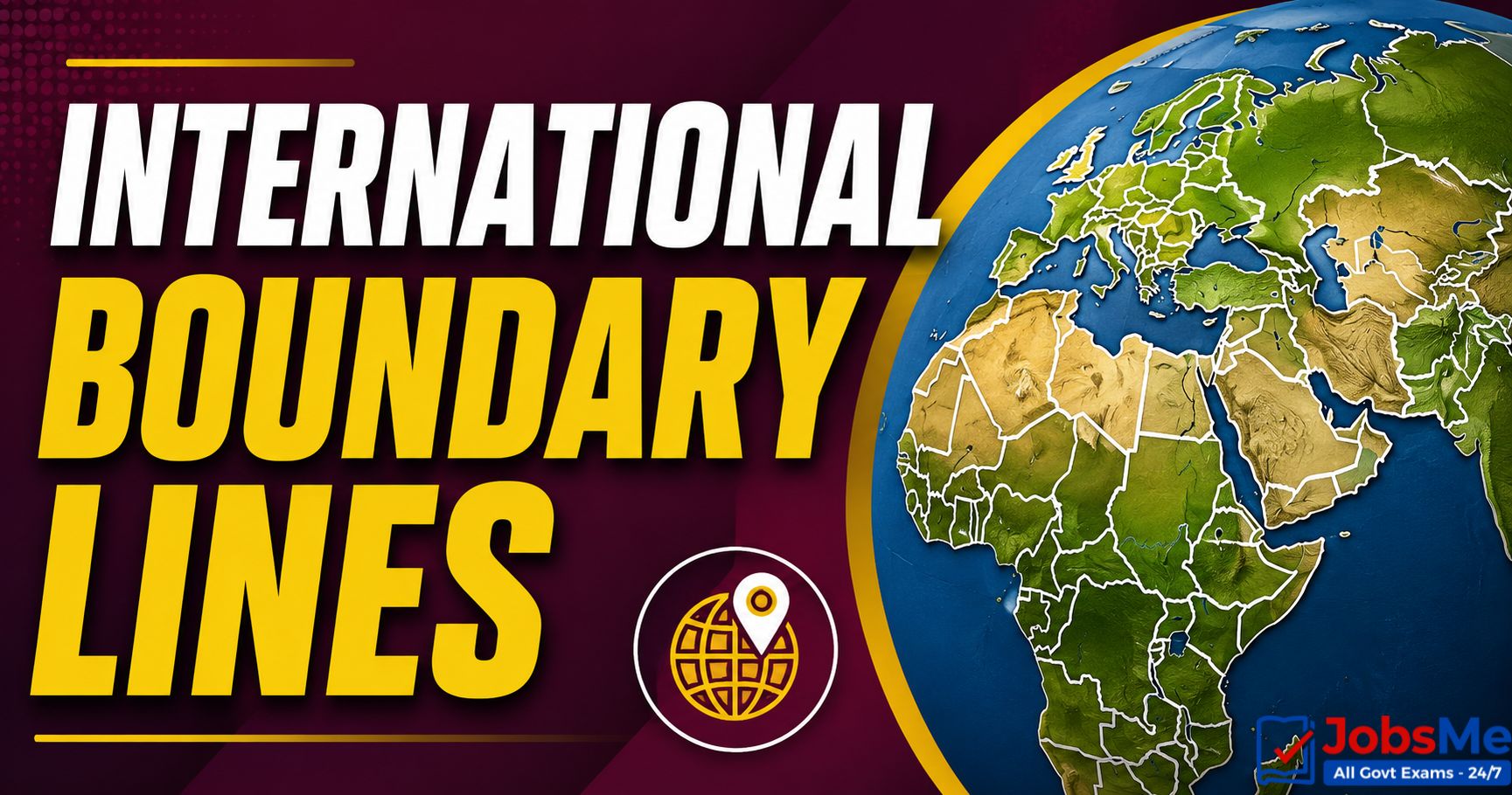
Borders of India with Neighbouring Countries – Static GK & General Awareness for Competitive Exams with Memory Tricks
This article provides a complete and updated list of borders of India with its neighbouring countries along with border lengths, bordering Indian states, capitals, currencies, languages, and border guarding forces, making it an essential resource for UPSC, SSC, IBPS, RRB, Defence, and other government exam aspirants. India has 9 neighbours — 7 sharing land borders (Bangladesh, China, Pakistan, Nepal, Myanmar, Bhutan, Afghanistan) and 2 sharing maritime borders (Sri Lanka and Maldives) — covering a total land border of about 15,106.7 km and a coastline of 7,516.6 km. The article includes detailed tables, memory tricks, one-liners, and FAQs to help students score better in General Awareness sections.
Jump to section
- Introduction
- Core Concepts: India's Geographical Position
- List of Neighbouring Countries of India with Borders
- India's Land Borders - Detailed Quick Reference
- Indian States and the Countries They Border
- Border Guarding Forces of India
- Country-Wise Detailed Profile of India's Neighbours
- India's Coastline - Quick Reference
- Major International Bodies India is Part of With Neighbours
- Memory Tricks and Mnemonics
- Additional Notes
- One-Liners for Quick Revision
Introduction
India occupies a unique strategic location in South Asia, sharing its borders with nine neighbouring countries — seven by land and two by sea. India's total land border stretches across approximately 15,106.7 km, while its coastline measures around 7,516.6 km. From the snow-clad heights of the Himalayas bordering China, Nepal, and Bhutan to the marshy Sundarbans bordering Bangladesh, and from the deserts of Thar facing Pakistan to the Palk Strait separating us from Sri Lanka — India's borders define its geopolitical identity, security framework, and trade relations.
Questions on India's borders with neighbouring countries appear regularly in UPSC Prelims, SSC CGL, IBPS PO, RRB NTPC, SBI Clerk, State PCS, and various Insurance and Defence exams. Questions typically ask about which Indian states border a particular country, the length of the border, the name of the border line, the capital and currency of the neighbour, and the border guarding force deployed. This article brings together all the key facts in a structured, exam-ready format. To explore other related Static GK topics, you can refer to the Important Boundary Lines of the World and India - Static GK guide on Jobsme.in.
India's borders are also closely linked to current affairs themes such as the India-China LAC standoff, ceasefire violations along the LoC, the Indo-Myanmar Free Movement Regime suspension, India-Maldives diplomatic developments, and SAARC cooperation — making this topic doubly important for aspirants targeting UPSC Mains GS-II (International Relations) and Defence interviews.
Core Concepts: India's Geographical Position
Understanding India's geographical setting is essential before memorising border facts, as exam questions often test conceptual knowledge.
Key Geographical Facts of India
- Total land border: ~15,106.7 km.
- Total coastline: ~7,516.6 km (mainland + island territories).
- Total neighbouring countries: 9 (7 land + 2 maritime).
- Hemisphere: Northern Hemisphere (latitudinally) and Eastern Hemisphere (longitudinally).
- Position globally: 7th largest country by land area.
- States/UTs touching international borders: 17.
- Standard Meridian of India: 82°30′ E longitude (passes through Mirzapur, UP).
- Tropic of Cancer: Passes through 8 Indian states.
Types of Borders India Shares
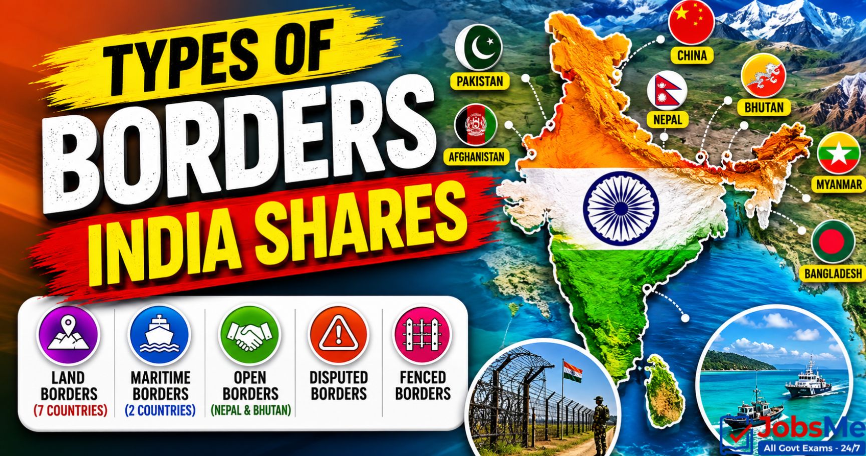
- Land Borders (7 countries): Bangladesh, China, Pakistan, Nepal, Myanmar, Bhutan, Afghanistan.
- Maritime Borders (2 countries): Sri Lanka and Maldives.
- Open Borders: India-Nepal and India-Bhutan (no visa required for citizens).
- Disputed Borders: India-China (LAC, Aksai Chin, Arunachal Pradesh) and India-Pakistan (LoC in J&K, Sir Creek).
- Fenced Borders: Most of India-Pakistan and India-Bangladesh borders are heavily fenced.
List of Neighbouring Countries of India with Borders
The following table presents all 9 neighbours of India along with border length, bordering states, capital, currency, and key features.
| S.No | Country | Border Length | Capital | Currency | Indian States/UTs Bordering | Key Features / Exam Notes |
|---|---|---|---|---|---|---|
| 1 | Bangladesh | ~4,096.7 km | Dhaka | Bangladeshi Taka | West Bengal, Assam, Meghalaya, Tripura, Mizoram (5 states) | India's longest land border; demarcated by Radcliffe Line; created in 1971 with India's support; common language Bengali. |
| 2 | China | ~3,488 km | Beijing | Chinese Yuan (Renminbi) | Ladakh (UT), Himachal Pradesh, Uttarakhand, Sikkim, Arunachal Pradesh (5 states/UTs) | Border via Line of Actual Control (LAC) + McMahon Line (eastern sector); disputed; flashpoints — Galwan, Doklam, Aksai Chin. |
| 3 | Pakistan | ~3,323 km | Islamabad | Pakistani Rupee | Gujarat, Rajasthan, Punjab, Jammu and Kashmir, Ladakh (UT) (4 states + 1 UT) | Demarcated by Radcliffe Line (1947); LoC in J&K from Shimla Agreement (1972); Wagah-Attari border crossing. |
| 4 | Nepal | ~1,751 km | Kathmandu | Nepalese Rupee | Uttarakhand, Uttar Pradesh, Bihar, Sikkim, West Bengal (5 states) | Open border via Treaty of Sugauli (1816) and Treaty of Peace and Friendship (1950); only Hindu-majority nation other than India. |
| 5 | Myanmar | ~1,643 km | Naypyidaw (largest city: Yangon) | Burmese Kyat | Arunachal Pradesh, Nagaland, Manipur, Mizoram (4 states) | Gateway to Southeast Asia under Act East Policy; Moreh-Tamu trade point; Free Movement Regime (FMR) recently restricted. |
| 6 | Bhutan | ~699 km | Thimphu | Bhutanese Ngultrum (pegged to INR) | Sikkim, West Bengal, Assam, Arunachal Pradesh (4 states) | Open border; Treaty of Peace and Friendship (1949, revised 2007); India supplies defence and imports hydropower. |
| 7 | Afghanistan | ~106 km | Kabul | Afghan Afghani | Ladakh (UT) — via PoK | Shortest land border; lies entirely in Pakistan-Occupied Kashmir; corridor to Central Asia under India's connectivity vision. |
| 8 | Sri Lanka | Maritime (Sea Border) | Sri Jayawardenepura Kotte (Legislative); Colombo (Commercial) | Sri Lankan Rupee | Tamil Nadu (across sea) | Separated by Palk Strait, Gulf of Mannar, and Adam's Bridge; shortest distance ~30 km; Katchatheevu Island ceded in 1974. |
| 9 | Maldives | Maritime (Sea Border) | Malé | Maldivian Rufiyaa | Lakshadweep (across sea) | Located southwest of India; ~700 km from Lakshadweep; smallest Asian country by area and population. |
India's Land Borders - Detailed Quick Reference
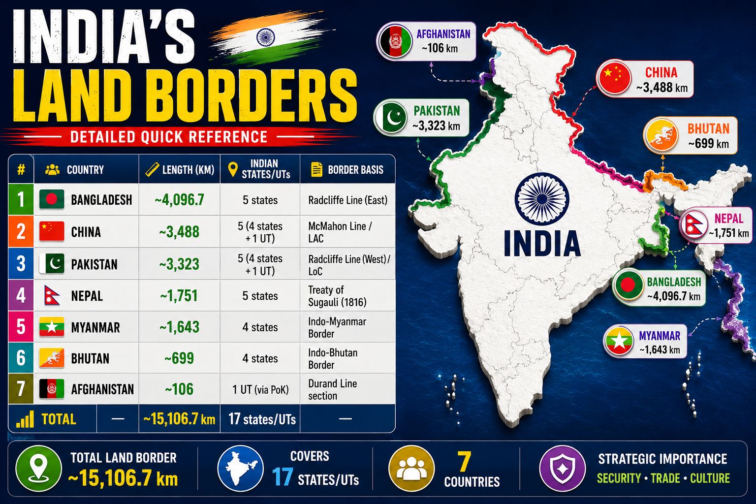
The table below presents India's seven land neighbours in descending order of border length — a high-yield list for SSC, RRB, and State PCS exams.
| Rank | Country | Border Length (km) | Number of Indian States/UTs | Border Line Name |
|---|---|---|---|---|
| 1 | Bangladesh | ~4,096.7 | 5 states | Radcliffe Line (East) |
| 2 | China | ~3,488 | 5 (4 states + 1 UT) | McMahon Line / LAC |
| 3 | Pakistan | ~3,323 | 5 (4 states + 1 UT) | Radcliffe Line (West) / LoC |
| 4 | Nepal | ~1,751 | 5 states | Treaty of Sugauli (1816) |
| 5 | Myanmar | ~1,643 | 4 states | Indo-Myanmar Border |
| 6 | Bhutan | ~699 | 4 states | Indo-Bhutan Border |
| 7 | Afghanistan | ~106 | 1 UT (via PoK) | Durand Line section |
| Total | — | ~15,106.7 km | 17 states/UTs | — |
Indian States and the Countries They Border
Many exam questions test the reverse — which neighbouring country a particular Indian state borders. This table provides that reference.
| Indian State / UT | Neighbouring Country / Countries |
|---|---|
| Jammu and Kashmir | Pakistan |
| Ladakh (UT) | Pakistan, China, Afghanistan (via PoK) |
| Himachal Pradesh | China |
| Uttarakhand | China, Nepal |
| Uttar Pradesh | Nepal |
| Bihar | Nepal |
| Sikkim | China, Nepal, Bhutan |
| West Bengal | Bangladesh, Nepal, Bhutan |
| Assam | Bangladesh, Bhutan |
| Meghalaya | Bangladesh |
| Tripura | Bangladesh |
| Mizoram | Bangladesh, Myanmar |
| Manipur | Myanmar |
| Nagaland | Myanmar |
| Arunachal Pradesh | China, Bhutan, Myanmar |
| Punjab | Pakistan |
| Rajasthan | Pakistan |
| Gujarat | Pakistan |
Border Guarding Forces of India
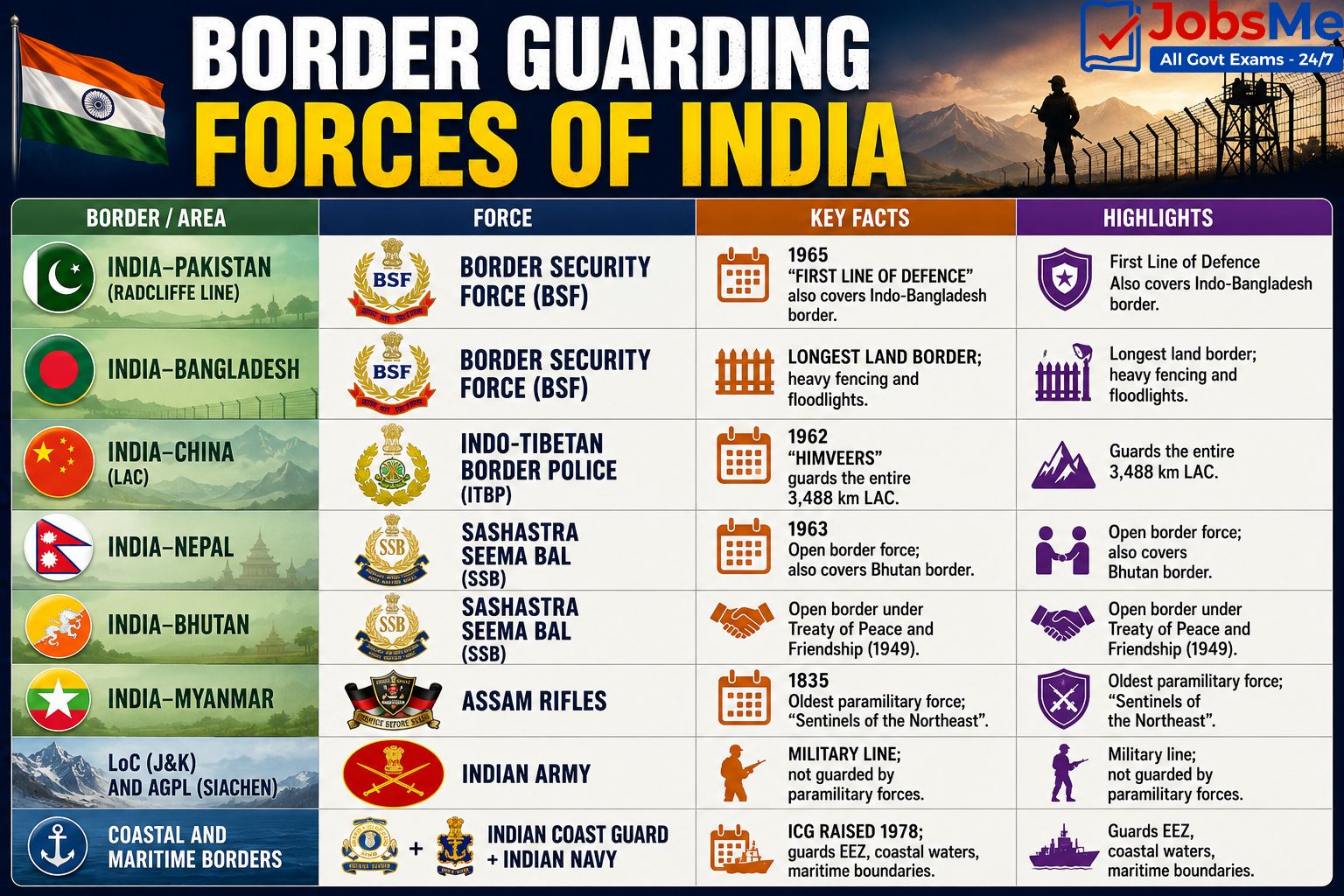
India deploys specialised Central Armed Police Forces (CAPFs) and the Army to guard its different international borders. This is a frequently asked topic in SSC, RRB, Defence, and CAPF exams.
| Border | Guarding Force | Raising Year / Key Notes |
|---|---|---|
| India-Pakistan (Radcliffe Line) | Border Security Force (BSF) | 1965; "First Line of Defence"; also covers Indo-Bangladesh border. |
| India-Bangladesh | Border Security Force (BSF) | Longest land border; heavy fencing and floodlights. |
| India-China (LAC) | Indo-Tibetan Border Police (ITBP) | 1962; "Himveers"; guards the entire 3,488 km LAC. |
| India-Nepal | Sashastra Seema Bal (SSB) | 1963; open border force; also covers Bhutan border. |
| India-Bhutan | Sashastra Seema Bal (SSB) | Open border under Treaty of Peace and Friendship (1949). |
| India-Myanmar | Assam Rifles | 1835; oldest paramilitary force; "Sentinels of the Northeast". |
| LoC (J&K) and AGPL (Siachen) | Indian Army | Military line; not guarded by paramilitary forces. |
| Coastal and Maritime Borders | Indian Coast Guard + Indian Navy | ICG raised 1978; guards EEZ, coastal waters, maritime boundaries. |
Country-Wise Detailed Profile of India's Neighbours
1. Bangladesh - Longest Land Neighbour
- Border length: ~4,096.7 km (longest of any Indian neighbour).
- Capital: Dhaka. Currency: Bangladeshi Taka. Languages: Bengali.
- Indian states bordering: West Bengal, Assam, Meghalaya, Tripura, Mizoram (5 states).
- Border line: Eastern Radcliffe Line (drawn 1947).
- Key history: Created in 1971 with India's support; Land Boundary Agreement (LBA) implemented in 2015; 162 enclaves exchanged.
2. China - Disputed Northern Neighbour
- Border length: ~3,488 km.
- Capital: Beijing. Currency: Chinese Yuan (Renminbi). Languages: Mandarin.
- Indian states/UTs bordering: Ladakh (UT), Himachal Pradesh, Uttarakhand, Sikkim, Arunachal Pradesh.
- Border lines: McMahon Line (1914, eastern sector) and Line of Actual Control (LAC overall) — disputed by China.
- Key issues: Aksai Chin (under Chinese control), Arunachal Pradesh (claimed as "South Tibet"), Galwan clash (2020), Doklam standoff (2017); Panchsheel Agreement (1954); 1962 War.
3. Pakistan - Western Neighbour
- Border length: ~3,323 km.
- Capital: Islamabad. Currency: Pakistani Rupee. Languages: Urdu.
- Indian states/UTs bordering: Gujarat, Rajasthan, Punjab, Jammu and Kashmir, Ladakh (UT).
- Border lines: Western Radcliffe Line (1947); Line of Control (LoC) in J&K from Shimla Agreement 1972; AGPL in Siachen.
- Key crossings: Wagah-Attari (Punjab), Munabao-Khokhrapar (Rajasthan); wars of 1947-48, 1965, 1971, Kargil (1999).
4. Nepal - Northern Open-Border Neighbour
- Border length: ~1,751 km.
- Capital: Kathmandu. Currency: Nepalese Rupee. Languages: Nepali.
- Indian states bordering: Uttarakhand, Uttar Pradesh, Bihar, Sikkim, West Bengal.
- Border treaties: Treaty of Sugauli (1816); Treaty of Peace and Friendship (1950).
- Key facts: Open border; landlocked country; Mt Everest on China-Nepal border; Lipulekh, Kalapani disputes.
5. Myanmar - Gateway to Southeast Asia
- Border length: ~1,643 km.
- Capital: Naypyidaw (largest city: Yangon). Currency: Burmese Kyat. Languages: Burmese.
- Indian states bordering: Arunachal Pradesh, Nagaland, Manipur, Mizoram.
- Key crossings: Moreh-Tamu (Manipur).
- Key facts: Pivot of India's Act East Policy; Free Movement Regime (FMR) recently suspended; counter-insurgency cooperation.
6. Bhutan - Himalayan Friend
- Border length: ~699 km.
- Capital: Thimphu. Currency: Bhutanese Ngultrum (pegged 1:1 with INR). Languages: Dzongkha.
- Indian states bordering: Sikkim, West Bengal, Assam, Arunachal Pradesh.
- Border treaty: Treaty of Peace and Friendship (1949, revised 2007).
- Key facts: Open border; only country with Gross National Happiness index; major hydropower partner of India; Doklam tri-junction with China.
7. Afghanistan - Shortest Land Border
- Border length: ~106 km (shortest).
- Capital: Kabul. Currency: Afghan Afghani. Languages: Dari, Pashto.
- Indian states/UTs bordering: Ladakh (via Pakistan-Occupied Kashmir).
- Border line: Small section of Durand Line falls within India's claimed PoK region.
- Key facts: India built Salma Dam, Afghan Parliament, and Zaranj-Delaram highway; strategically vital for India's Central Asian connectivity vision.
8. Sri Lanka - Southern Maritime Neighbour
- Border: Maritime (sea border).
- Capital: Sri Jayawardenepura Kotte (legislative); Colombo (commercial). Currency: Sri Lankan Rupee. Languages: Sinhala, Tamil.
- Separated by: Palk Strait, Palk Bay, Gulf of Mannar, and Adam's Bridge (Rama Setu).
- Shortest distance: ~30 km from Dhanushkodi (Tamil Nadu) to Talaimannar.
- Key facts: Katchatheevu Island ceded by India in 1974; LTTE history; IPKF intervention 1987-1990.
9. Maldives - Indian Ocean Neighbour
- Border: Maritime (sea border).
- Capital: Malé. Currency: Maldivian Rufiyaa. Languages: Dhivehi.
- Location: South-west of India in the Indian Ocean; about 700 km from Lakshadweep.
- Key facts: Smallest Asian country (~298 sq km); India's Operation Cactus (1988) thwarted a coup; India's Neighbourhood First and SAGAR doctrine partner.
India's Coastline - Quick Reference
| Aspect | Details |
|---|---|
| Total Coastline (Mainland + Islands) | ~7,516.6 km |
| Mainland Coastline | ~6,100 km |
| Coastal States (9) | Gujarat, Maharashtra, Goa, Karnataka, Kerala, Tamil Nadu, Andhra Pradesh, Odisha, West Bengal |
| Coastal UTs (4) | Daman and Diu (now part of D&NH and DD), Puducherry, Lakshadweep, Andaman and Nicobar Islands |
| State with Longest Coastline | Gujarat (~1,600 km) |
| State with Shortest Coastline | Goa (~101 km) |
| Seas Bordering India | Arabian Sea (west), Bay of Bengal (east), Indian Ocean (south) |
Major International Bodies India is Part of With Neighbours
| Organisation | Year Established | Headquarters | Member Neighbours |
|---|---|---|---|
| SAARC (South Asian Association for Regional Cooperation) | 1985 | Kathmandu, Nepal | India, Pakistan, Bangladesh, Sri Lanka, Nepal, Bhutan, Maldives, Afghanistan |
| BIMSTEC (Bay of Bengal Initiative) | 1997 | Dhaka, Bangladesh | India, Bangladesh, Myanmar, Sri Lanka, Bhutan, Nepal, Thailand |
| BBIN (Bangladesh-Bhutan-India-Nepal Initiative) | 2015 | — | India, Bangladesh, Bhutan, Nepal |
| SCO (Shanghai Cooperation Organisation) | 2001 (India joined 2017) | Beijing, China | India, Pakistan, China (among others) |
Memory Tricks and Mnemonics
Trick 1: India's 9 Neighbours - "Ban-Cha-Pak-Ne-My-Bhu-Af-Sri-Mal"
- Ban - Bangladesh.
- Cha - China.
- Pak - Pakistan.
- Ne - Nepal.
- My - Myanmar.
- Bhu - Bhutan.
- Af - Afghanistan.
- Sri - Sri Lanka.
- Mal - Maldives.
Tip: "BCPN-MBA-SM — 9 neighbours, top to bottom of border lengths."
Trick 2: Land Border Lengths in Order - "Bangladesh Tops, Afghanistan Tails"
- Bangladesh → ~4,096 km (longest).
- China → ~3,488 km.
- Pakistan → ~3,323 km.
- Nepal → ~1,751 km.
- Myanmar → ~1,643 km.
- Bhutan → ~699 km.
- Afghanistan → ~106 km (shortest).
Tip: "B-C-P-N-M-B-A — Big to Small, Bangladesh ALWAYS first, Afghanistan ALWAYS last."
Trick 3: 5-State Neighbours - "Three B-C-P"
Three neighbours border 5 Indian states/UTs each:
- B - Bangladesh (WB, Assam, Meghalaya, Tripura, Mizoram).
- C - China (Ladakh, HP, UK, Sikkim, Arunachal).
- P - Pakistan (Gujarat, Rajasthan, Punjab, J&K, Ladakh).
- Plus Nepal (Uttarakhand, UP, Bihar, Sikkim, WB).
Tip: "B-C-P-N each touch 5 Indian states/UTs."
Trick 4: 4-State Neighbours - "MBM"
- M - Myanmar (Arunachal, Nagaland, Manipur, Mizoram).
- B - Bhutan (Sikkim, WB, Assam, Arunachal).
Tip: "Myanmar and Bhutan each touch 4 states."
Trick 5: Capitals of Neighbours - "DBT-KIN-KCM"
- D - Dhaka (Bangladesh).
- B - Beijing (China).
- T - Thimphu (Bhutan).
- K - Kathmandu (Nepal).
- I - Islamabad (Pakistan).
- N - Naypyidaw (Myanmar).
- K - Kabul (Afghanistan).
- C - Colombo / Sri Jayawardenepura Kotte (Sri Lanka).
- M - Malé (Maldives).
Trick 6: Border Guarding Forces - "BIS-AC"
- B - BSF → Pakistan and Bangladesh.
- I - ITBP → China (LAC).
- S - SSB → Nepal and Bhutan.
- A - Assam Rifles → Myanmar.
- C - Coast Guard → Maritime (Sri Lanka, Maldives).
Tip: "BIS-AC — Be Smart and Active across India's borders."
Trick 7: Arunachal's Three Neighbours - "CBM"
- C - China.
- B - Bhutan.
- M - Myanmar.
Tip: "Arunachal Pradesh = CBM; the only Indian state with 3 international borders."
Trick 8: Ladakh's Three Neighbours - "CPA"
- C - China.
- P - Pakistan.
- A - Afghanistan (via PoK).
Tip: "Ladakh = CPA — the only UT touching three countries."
Trick 9: Sikkim's Three Neighbours - "CNB"
- C - China.
- N - Nepal.
- B - Bhutan.
Tip: "Sikkim CNB — Capital of Northern Borders."
Trick 10: West Bengal's Three Neighbours - "BBN"
- B - Bangladesh.
- B - Bhutan.
- N - Nepal.
Tip: "West Bengal touches Bangladesh, Bhutan, and Nepal."
Trick 11: 2 Maritime Neighbours - "Sri-Mal"
India's only two maritime neighbours are Sri Lanka and Maldives. Tip: "Sri-Mal — Sri Lanka in the southeast (Palk Strait), Maldives in the southwest (Indian Ocean)."
Trick 12: Open Borders of India - "Ne-Bhu"
India has open borders (no visa required) with only two countries — Nepal and Bhutan. Tip: "Ne-Bhu = No-visa neighbours."
Additional Notes
Frequently Confused Facts
- Total neighbours: 9 (7 land + 2 maritime) — including Sri Lanka and Maldives.
- Longest land border: Bangladesh (~4,096.7 km).
- Shortest land border: Afghanistan (~106 km, via PoK).
- Indian state with most international borders: Arunachal Pradesh (China, Bhutan, Myanmar = 3 neighbours).
- UT with most international borders: Ladakh (China, Pakistan, Afghanistan via PoK = 3 neighbours).
- State touching most neighbours via single border: Sikkim (China, Nepal, Bhutan).
- State touching 5 international borders: None directly — but West Bengal touches three countries (Bangladesh, Bhutan, Nepal).
- Open borders: India-Nepal and India-Bhutan (no visa required).
- Closed/fenced borders: India-Pakistan and India-Bangladesh (most fenced).
- Country with which India has NO border treaty officially recognising the line: China (LAC is undefined).
- Pakistan claims Sir Creek along: 24th Parallel (India does not accept).
- Capital confusion: Sri Lanka has two capitals — Sri Jayawardenepura Kotte (legislative) and Colombo (commercial).
- Myanmar capital: Naypyidaw (since 2005) — NOT Yangon (former capital, still largest city).
- Bhutan currency: Ngultrum, pegged 1:1 with the Indian Rupee.
- Maldives is NOT part of SAARC headquarters: SAARC HQ is in Kathmandu, Nepal.
- Adam's Bridge / Rama Setu: Chain of shoals between India (Dhanushkodi) and Sri Lanka (Talaimannar).
- Katchatheevu Island: Ceded to Sri Lanka by India in 1974.
Repeating PYQ Patterns
- UPSC Prelims: Frequently asks about which Indian state borders which country, total number of neighbours, SAARC and BIMSTEC members, and disputed border areas.
- SSC CGL and CHSL: Match-the-column questions linking countries to capitals and currencies; Bangladesh, China, Nepal, and Bhutan are most common.
- IBPS PO and Clerk: One-liner questions on capital cities, currencies, and border lengths.
- RRB NTPC and Group D: Direct questions on which Indian states share borders with which neighbour.
- State PCS: Region-specific border questions (e.g., Bihar PCS — Nepal border; West Bengal PSC — Bangladesh border).
- Defence and CAPF Exams: Border guarding forces (BSF, ITBP, SSB, Assam Rifles), border lengths, and crossings like Wagah, Moreh-Tamu, Nathu La.
Quick Insight
India's neighbours are central to current affairs themes such as the India-China LAC standoff in Eastern Ladakh, the Adani-Hasina ties with Bangladesh, the political crisis and FMR suspension in Myanmar, India-Maldives diplomatic frictions, the Taliban government in Afghanistan, and the India-Sri Lanka Katchatheevu controversy. Aspirants should regularly track India's "Neighbourhood First" policy, "Act East" initiatives, and the SAGAR doctrine. For the latest updates, follow the daily current affairs section on Jobsme.in.
This topic also pairs well with related Static GK areas such as Countries, Capitals and Currencies of the World and International Organisations and their Headquarters, since border diplomacy is often handled through SAARC, BIMSTEC, BBIN, and the SCO.
One-Liners for Quick Revision
- Total neighbouring countries of India → 9 (7 land + 2 maritime).
- Total land border of India → ~15,106.7 km.
- Total coastline of India → ~7,516.6 km.
- India's 7 land neighbours → Bangladesh, China, Pakistan, Nepal, Myanmar, Bhutan, Afghanistan.
- India's 2 maritime neighbours → Sri Lanka and Maldives.
- Longest land border → Bangladesh (~4,096.7 km).
- Shortest land border → Afghanistan (~106 km, via PoK).
- Bangladesh → Capital Dhaka → Currency Taka → States: WB, Assam, Meghalaya, Tripura, Mizoram → Radcliffe Line East.
- China → Capital Beijing → Currency Yuan/Renminbi → States/UTs: Ladakh, HP, Uttarakhand, Sikkim, Arunachal → McMahon Line / LAC.
- Pakistan → Capital Islamabad → Currency Pakistani Rupee → States/UTs: Gujarat, Rajasthan, Punjab, J&K, Ladakh → Radcliffe Line / LoC.
- Nepal → Capital Kathmandu → Currency Nepalese Rupee → States: Uttarakhand, UP, Bihar, Sikkim, WB → Open border; Treaty of Sugauli 1816.
- Myanmar → Capital Naypyidaw (largest city Yangon) → Currency Kyat → States: Arunachal, Nagaland, Manipur, Mizoram → Moreh-Tamu crossing; FMR suspended.
- Bhutan → Capital Thimphu → Currency Ngultrum → States: Sikkim, WB, Assam, Arunachal → Open border; Peace and Friendship Treaty 1949.
- Afghanistan → Capital Kabul → Currency Afghani → UT: Ladakh (via PoK) → Durand Line section; shortest border.
- Sri Lanka → Legislative capital Sri Jayawardenepura Kotte / Commercial Colombo → Currency Sri Lankan Rupee → Maritime; Palk Strait, Gulf of Mannar.
- Maldives → Capital Malé → Currency Rufiyaa → Maritime; ~700 km from Lakshadweep.
- Border force on Indo-Pak and Indo-Bangladesh border → Border Security Force (BSF, raised 1965).
- Border force on Indo-China border → Indo-Tibetan Border Police (ITBP, raised 1962).
- Border force on Indo-Nepal and Indo-Bhutan border → Sashastra Seema Bal (SSB, raised 1963).
- Border force on Indo-Myanmar border → Assam Rifles (1835, oldest paramilitary).
- Border force on coastal/maritime border → Indian Coast Guard (1978) + Indian Navy.
- LoC (J&K) and AGPL (Siachen) are guarded by → Indian Army.
- Indian state with most international borders → Arunachal Pradesh (China, Bhutan, Myanmar).
- Indian UT with most international borders → Ladakh (China, Pakistan, Afghanistan via PoK).
- Indian state touching China, Nepal, and Bhutan → Sikkim.
- Indian state touching Bangladesh, Bhutan, and Nepal → West Bengal.
- Indian state touching only Pakistan → Gujarat, Rajasthan, Punjab.
- Indian state touching only Bangladesh → Meghalaya, Tripura.
- Indian state touching only Myanmar → Manipur, Nagaland.
- Indian state touching only Nepal → Bihar, Uttar Pradesh.
- Indian state touching only China → Himachal Pradesh.
- Indian state touching China and Nepal → Uttarakhand.
- Indian state touching Bangladesh and Myanmar → Mizoram.
- Indian state touching Bangladesh and Bhutan → Assam.
- Total Indian states/UTs touching international borders → 17.
- Tropic of Cancer passes through → 8 Indian states (Gujarat, Rajasthan, MP, Chhattisgarh, Jharkhand, WB, Tripura, Mizoram).
- Standard Meridian of India → 82°30′ E (passes through Mirzapur, UP).
- Indian state with longest coastline → Gujarat (~1,600 km).
- Indian state with shortest coastline → Goa (~101 km).
- SAARC → Established 1985 → HQ Kathmandu, Nepal → 8 members.
- BIMSTEC → Established 1997 → HQ Dhaka, Bangladesh → Bay of Bengal grouping.
- BBIN → 2015 → Bangladesh-Bhutan-India-Nepal sub-regional grouping.
- Wagah-Attari Border → Punjab → India-Pakistan crossing; daily flag-lowering ceremony.
- Moreh-Tamu Border → Manipur → India-Myanmar trade point.
- Nathu La Pass → Sikkim → India-China border crossing.
- Petrapole-Benapole → West Bengal → Largest India-Bangladesh land port.
- Munabao-Khokhrapar → Rajasthan → India-Pakistan border (Thar Express).
- Highest international border in the world → China-Nepal → Passes through Mt Everest (8,848.86 m).
- India-China Panchsheel Agreement → 1954 → Five Principles of Peaceful Coexistence.
- India-China War → 1962 → Border conflict over Aksai Chin and NEFA.
- Land Boundary Agreement (LBA) → India-Bangladesh → Implemented 2015; 162 enclaves exchanged.
- Operation Cactus → 1988 → Indian intervention in Maldives to thwart a coup.
- Operation Meghdoot → 13 April 1984 → Indian operation to secure Siachen Glacier from Pakistan.
- Doklam Standoff → 2017 → India-China-Bhutan tri-junction in Sikkim sector.
- Galwan Valley Clash → June 2020 → India-China clash in Eastern Ladakh.
- Aksai Chin → Indian territory under Chinese occupation in eastern Ladakh.
- Arunachal Pradesh → Claimed by China as "South Tibet".
- Kalapani / Lipulekh / Limpiyadhura → India-Nepal border dispute (Uttarakhand).
- Katchatheevu Island → Ceded to Sri Lanka in 1974; recent controversy.
- Palk Strait and Gulf of Mannar → Separate India from Sri Lanka.
- Adam's Bridge / Rama Setu → Chain of shoals between Dhanushkodi (India) and Talaimannar (Sri Lanka).
- Act East Policy → Focus on Myanmar, ASEAN, and Indo-Pacific connectivity.
- Neighbourhood First Policy → India's policy of prioritising South Asian neighbours.
- SAGAR Doctrine → Security and Growth for All in the Region → India's Indian Ocean vision.
For more Static GK topics like mountains, rivers, and biosphere reserves of India, explore the Static GK section on Jobsme.in. You can also test your knowledge with the Static GK Quiz and check out the latest exam notifications at Latest Government Job Notifications.
Free quiz • No signup required
Put this topic into practice with Indian Cultural Institutions – Static GK MCQ Quiz. It is the quickest way to reinforce what you just learned.
Frequently Asked Questions
How many countries share borders with India?
Which country shares the longest border with India?
Which country shares the shortest land border with India?
Which Indian states share their borders with China?
Which Indian state has international borders with the most number of countries?
What is the total length of India's land border and coastline?
Which forces guard India's borders with different neighbours?
Which two countries are India's maritime neighbours?
What is the capital and currency of each of India's neighbours?
Which countries border India through open borders without visa requirements?

About the author